The Flood Event:
Red Rock Pass is a narrow valley just north of Cache Valley and directly south of Downey Idaho. It is bounded by two mountain ranges; the Portneuf to the East and the Bannock to the West. The pass is a tertiary normal faulted graben consisting of tuffaceous fine-grained clastics and carbonates of the Salt Lake formation overlain by unstable Quaternary Alluvial fan gravels carved out by a massive flooding event roughly 14,500 years ago.
During the Quaternary, alluvial gravels from the two ranges coalesced to create a saddle shaped dam. The rising Lake Bonneville was halted by this alluvial dam at the Zenda threshold approximately 16 thousand years ago. The threshold was first breached to the east side of Red Rock Pass, at about 14,500 years ago, eroding out the alluvial fan. Its base level was controlled by the resistant karstic limestone of the Blacksmith Formation.
The outflow ultimately slid to the west undercutting the alluvium at the foot of the Bannock and prompting a 17 square kilometer landslide. This landslide was then truncated by the flood causing massive flood deposits of alluvial gravel under what are now Downey and the surrounding valley. From the break point at Red Rock Pass, the flood route flowed into the Marsh Creek Valleys, through the Portneuf Narrows and into Snake River Plain just North of Idaho. From there if followed the Snake River Canyon into Michaud Flats and up to Lewiston, where confirmation of the Bonneville Flood is obscured by the effects of the Missoula Flood.
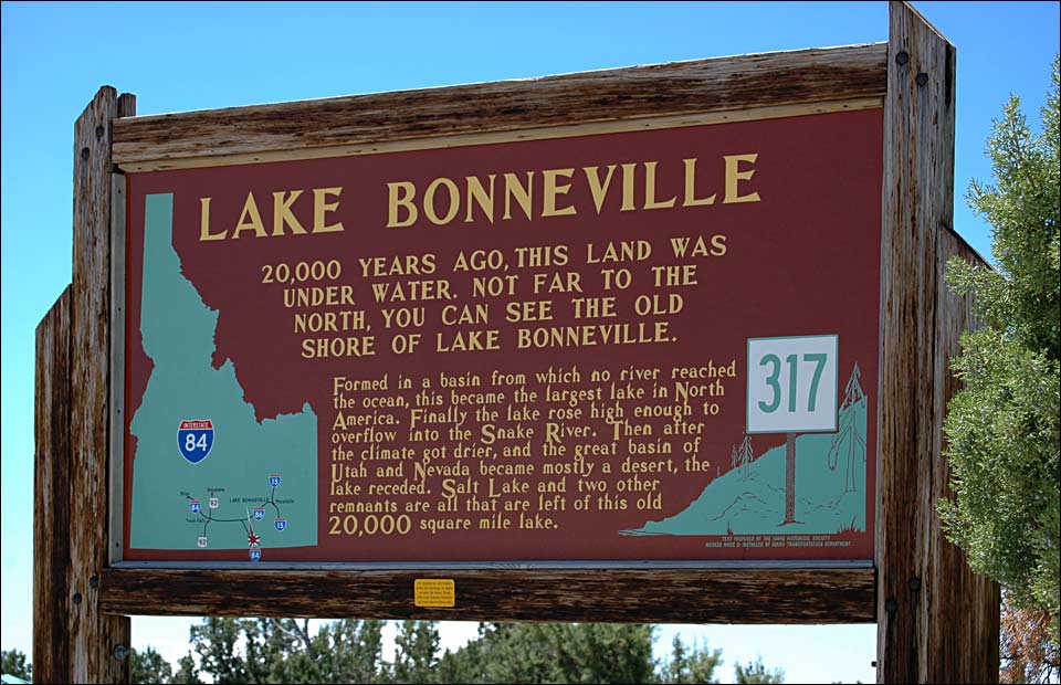
Fig2
Roadside Information sign.
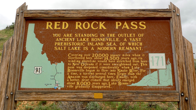
Fig 3
Roadside Information sign.